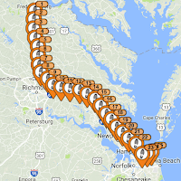
The SPOT Gen3 also allows the user to set-up a map view that will give private or public guests the ability to see a recent track and your current location via a SPOT hosted web page. Very nice if you desire to allow others to see the progress of your latest journey.
 Even with all of these great features, in our opinion the SPOT Gen3 check-in location mapping has a few weaknesses. (1) The map view provided with the SPOT subscription limits your guests to only see a maximum of the last seven days of your check-in locations, and (2) only in small groups of sequential check-ins (i.e. not your entire trip, start to finish). (3) The locations are displayed on the SPOT web site as individual points with a large "flag" that makes the actual route difficult to view on the map. (4) There is no way to join the individual points to represent an approximate route of your journey. And finally, (5) the check-in location data is only retained by SPOT for thirty days.
SPOT offers their Adventures feature to overcome the thirty-day limit so that you can save check-in location data for yourself or to share with others as part of the SPOT social / community pages. However, it does not overcome the other mapping shortfalls. It also means that your data is stored in the cloud with SPOT which presents certain privacy concerns and the data is not necessary easily accessible to you, especially if you are off the grid without Internet access.
We desired a way to review larger sets of our check-in locations to see the entire route of a specific trip and to be able to share that view with others; preferably on a mapping application like Google Earth so that the user can have other options to adjust their map view. Here is a way for you to create such a map and overcome the limits of the SPOT Gen3 mapping service.
After your trip is done and before the thirty-day limit is over (and your check-in location data disappears) go to your SPOT account page. Navigate to My Locations and simply select the download option to save the data to your computer. It is very important that when you initially select the download link that you then select the advanced download link. That will give you the option to filter the data for the range of days of your choice. If you do not use this advanced option, you will only download the subset of check-in locations that are displayed on the data selection page. Be certain to save this data download as a KML file, an xml format that is compatible with Google Earth
Now you are going to use a great online application called GPS Visualizer. This is an online utility that creates maps and profiles from geographic data. It is easy to use and free, although we suggest that you give the developers a generous donation if you find the application as useful as we did.
There are two steps to this process with GPS Visualizer. The first is to convert the SPOT Gen3 KML file to a text file of check-in locations. Use the GPS Visualizer Convert To Plain Text feature with the default options. The online conversion should complete very quickly and save the new text file to your computer.
The second step is to convert the new created text file into a KML file. Use the GPS Visualizer Google Earth KML feature with the default options, except to "Force plain text to be this type: trackpoints." This option is important if you desire to have your check-in locations joined by a line that approximates your journey. This second conversion should also complete quickly and will create a KML file that you can now open in Google Earth.
The result is a collection of your SPOT Gen3 check-in locations displayed as a continuous line representing your trip. The KML file can be shared as-is, or you can publish or share the Google Earth image as desired. We maintain a library of our trips as KML files for later reference. With the map view options offered by Google Earth, we can easily manipulate the image as we wish. Hopefully, this process may prove useful to other SPOT Gen3 users too.


No comments:
Post a Comment